
Well. Survived Nankoweep. Beautiful trail…but whoa
Just to give you an idea…here’s one guy’s description of it:
“This trail is not one to be taken lightly. The Park Service lists it being the "MOST difficult of the named trails in Grand Canyon" and after hiking it once I would have to say that I must agree with that classification. The Nankoweap in many places is simply trouble waiting to happen and unless you've got a lot of Canyon miles under your boots I would not suggest that this trail be attempted. If, however, you do have those miles under your boots, want to see some extremely wild regions of the Canyon and feel comfortable that you are at peace with your maker (in case hiking the Nankoweap results in your meeting he or she somewhat sooner than you may have expected), then the Nankoweap is for you.”
that about sums it up….
Started out at point imperial for sunrise. (above photo) Then headed into the forest for 2 miles…out of park boundaries down to saddle mountain and back into park boundaries at the trailhead. Pretty steep decent through Coconino crap and hermit shale…

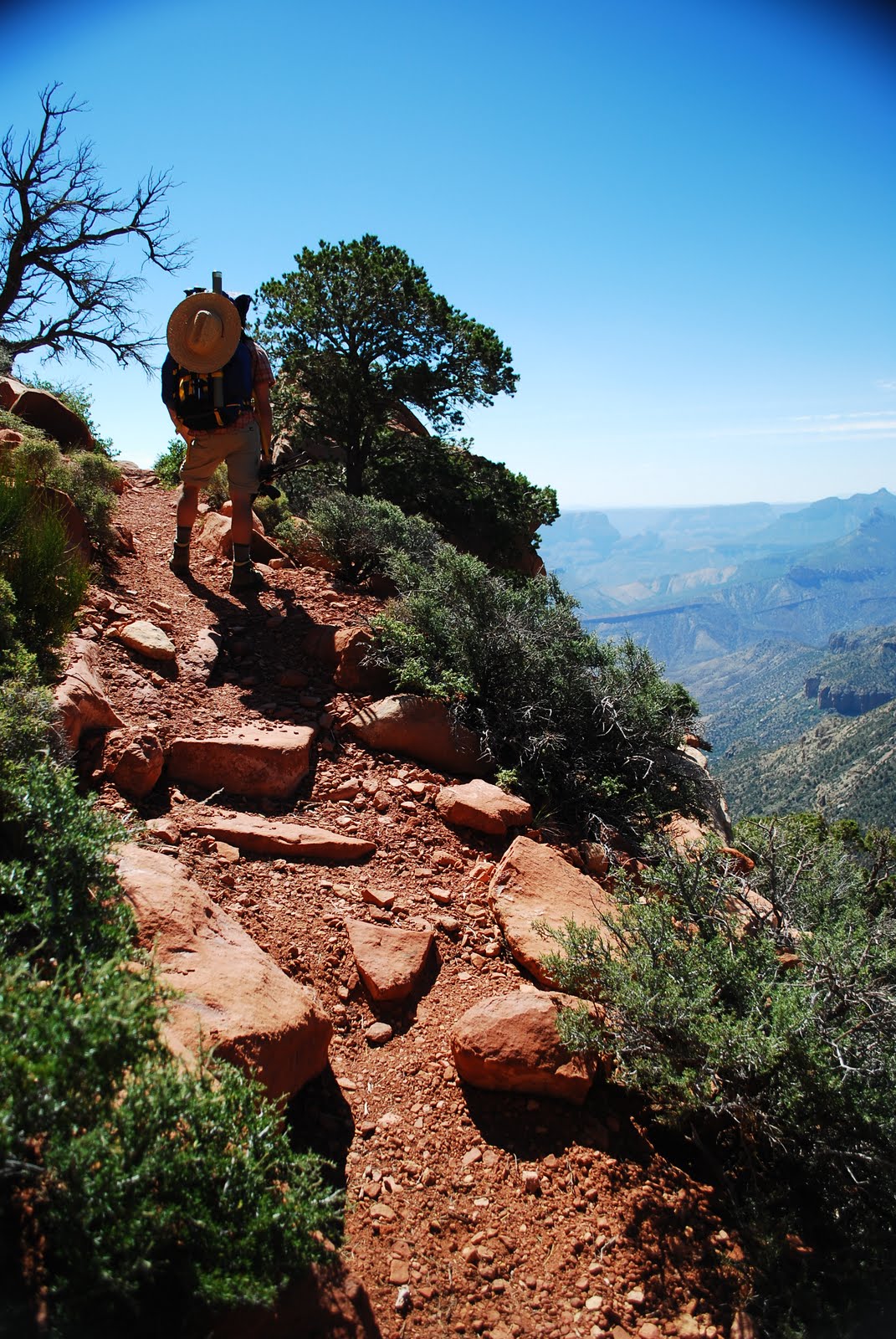
Jesse heading up at the start of the Supai Group (right)
Longest part of the hike was probably around the Supai. Relatively level but along a cliff edge on your right and cliff walls on your left. Relatively sketchy.
Chilled at tilted mesa for a little siesta. Had some issues locating the trail and finally found out. Turns out you have to climb down about 10 feet around rock and tree.
Slogan for most of trip from Jesse: "They used to bring horses on this"

True story. Used to be used by the natives here and then by outlaw characters who would steal horses in Utah and sneak them down to the border via nankoweep. Don’t know how you’d get a horse down that tree but I’m sure they had their tricks.
Jesse and trail tree on right...interesting with a 30 pound pack on your back

View from right after Tilted Mesa
Continued down through the redwall limestone, muav, and bright angel shale into the tapeats sandstone (which may have the coolest looking stuff of all the formations). Definitely a trek that one. Steep down hill and real loose, scrambly trail. Decided not to try for the river since it was getting dark and stopped at a nice little campsite. Primitive, no ammo boxes, picnic tables or water on this route.

Headed down to the creek in the morning for water and breakfast. Lovely shady little oasis down there (right). Then along the creek down to the river. Lunch…and hot and sun…checked out the granaries briefly and then headed back.


Good old colorady river and some granaries on the right...Little square holes right in the middle (hard to see...was too lazy to try and get any closer)
Trip back up was a challenge. Definitely. Pretty much all up hill until the supai group then more uphill. We ended up hiking into the night til we got to Marion point. Napped for a bit then made it back up to point imperial around 12:30 Monday afternoon.
Low and behold an angel was waiting for us next to the truck…Offering us ice cold tecate (beer) and chocolate. Though it might be a dream…or me seeing the maker.
Quite a journey. Great trail but might wait for fall or spring to do it next time. Definitely a test of strength and self-preservation haha

End of the road at Point Imperial trailhead. (Notice leaning on the sign for support)


No comments:
Post a Comment